Hi folks!
It’s been awhile since I’ve pounded out a post on Tingo Hikes, but I promise you that I have not been sitting idle in the meantime. In fact, I am freshly back from Maine, having returned to complete my thru hike of the Appalachian Trail by facing down Mount Katahdin, easily one of the most remote, imposing, and treacherous winter summits in the whole of the eastern United States. This is the story of how it all went down.
Snowed-out of the opportunity to hike to the northern terminus of the AT in mid October, you can bet that there were a number of disappointed would-be thru hikers leaving Baxter state park feeling pretty bummed, myself included. With just 5.2 miles of trail left to complete, we had hiked 99.76% of the 2,197.4 total mileage. For many, this could be considered close enough to completion, but I was constantly reminded that my hike had an asterisk on it. I’d say to somebody, “I hiked the Appalachian Trail this summer,” only to be countered with the shocked retort, “Wow! The whole thing?!” Well…
Not content to settle for “almost”, a few of my fellow hikers began hatching plans for a winter ascent; our last hope for a 2024 AT thru hike completion. As a reminder, Baxter state park closes all trails to the summit of Mount Katahdin in the fringe seasons (i.e. autumn and spring) in order to protect the fragile alpine plants on the summit. A mere dusting of snow on the mountain top makes it hard to know where you’re stepping, and these plants get stomped by those that wander from the trail. However, when there’s enough snow to protect the plant life, the summit is reopened for winter ascents.
At first, me and about seven other hikers reached out to an outdoor guide in Maine to lead us on a trip up the mountain. After all, most of us had little to no experience winter hiking, let alone in the mountains, and let alone on one of the toughest mountains on the east coast. After a few conversations, though, the sticker shock of a $1,500 per person guided expedition was enough to scare off most of us, including me. But, we were still determined to get to the top of the mountain and complete our thru hike. How hard could it be?
It could be very hard, as we would learn in short order. This is the part of my post where I’ll post a warning. Hiking Mount Katahdin in the winter is difficult, and should not be undertaken without proper respect and precautions. Weather can be extreme, the hiking is brutal, avalanche conditions can be present, and rescue is not guaranteed. We entered into this hike knowing fully that our safety was entirely our responsibility. We spent a lot of time preparing to tackle this hike safely, from researching routes, procuring the proper gear, creating contingency plans, and more. Once again, this hike is not to be taken lightly.
So, let’s get into it, starting with gear. In addition to everything else that I would usually carry on the rest of my thru hike, I also had to make the following gear adjustments:
- A larger backpack (I swapped out my ultralight Superior Wilderness Designs pack for a heavier-duty Kifaru pack that could handle more weight)
- Waterproof, insulated hiking boots rather than trail runners
- A thermos (it’s quite a luxury to enjoy hot tea on a cold mountain top)
- A cold weather sleep system (I replaced my 32 degree bag with a -30 degree bag, and procured an inflatable sleeping pad with a greater insulating capacity)
- Winter layers, lots of them (gloves, hat, a waterproof coat, winter base layers, thick wool socks, waterproof pants, a balaclava, and extra dry layers for when they got wet)
- An ice axe (the true MVP gear of the trip, an ice axe is useful for grabbing hold of rocks or ice, chiseling steps into steep snow, or, God forbid, self-arresting an accidental slide down the mountain)
- Crampons (essentially big spikes for your shoes, good for when there’s steep ice/snow)
- Microspikes (smaller spikes for your shoes than crampons, good for glare ice)
- Snowshoes (for walking on top of deep snow)
- Iodine tablets (I used these to purify water rather than my good ‘ol filter, which would have frozen)
- Way more food than I would usually pack; particularly stuff that wouldn’t freeze
All in all, my pack weighed a gruesome 54 pounds once I added food in. Being used to a pack of rarely more than 20 pounds for the rest of my hike, this was no insignificant weight gain. Shoutout to Kifaru for making a great pack that can carry that weight so comfortably!

Our summit party consisted of four individuals:
- Alpine (that’s me!)
- Hot Foot – a hiker I met halfway through the AT and hiked on and off with at various intervals on our way to Maine; a tragically sarcastic guy.
- Van Gogh – a hiker I met near Saddleback Mountain in Maine; this is his second thru hike of the AT, which he hiked with his sweet dog, Riley; looks like Vincent Van Gogh.
- Alan – not a thru hiker, but Hot Foot’s friend from PA; an avid boulderer (a subsection of rock climbing), a decent photographer, and a congenial dude (not pictured below because I didn’t get a mountain shot of him for some reason).


Now let’s talk logistics. Submitting Katahdin was going to require primary plan and a backup plan. For us, that looked like this:
- Day 1: I fly to Portland, ME, where Alan and Van Gogh will pick me up while driving north from Pennsylvania and Maryland, respectively. We’ll stay the night in Kingfield, ME, where Hot Foot works at Sugarloaf Mountain ski resort.
- Day 2: Drive 3 hours to Baxter state park and hike the ten miles in to Katahdin Stream camp. Set up base camp and spend the night.
- Days 3 – 5: Potential summit days. If the weather is foul (i.e. snowy, rainy, blizzard-y, etc.), then we’ll wait at basecamp for the next day, crossing our fingers the weather will improve. Ideally, we summit on day 3, right away.
- Day 4 (or maybe 5 or 6): Hike out of Baxter state park and drive 3 hours back to Kingfield.
- Day 5 (or, perhaps, day 6 or 7): I fly back to the Midwest as a freshly minted thru hiker!
I know what you’re thinking; that that’s a lot of days potentially sitting and waiting around at camp if the weather is bad. Worry not, though, I packed a cribbage board and swore to my party members that I would forcibly educate them if necessary.
Enough preamble, let’s talk about the amble! The trip out to Maine was easy enough. My mom was kind enough to give me a lift to the Minneapolis airport for my 5:15 AM flight (thanks again for that early, early ride!), and my flight to Portland was uneventful. I waited in Portland for Alan and Van Gogh to show up, as they were picking me up on their drive north from PA/MD. From Portland, we drove north to stay at Terrapin Hostel in Kingfield, ME. It was a hostel that I hadn’t taken time to visit while hiking the trail, but I can 100% recommend it!

We woke up early Saturday, December 14th to drive to Baxter state park. Almost immediately, we hit our first snag when the wire cable supporting a telephone pole ripped the bumper off of Alan’s car. Luckily, Hot Foot’s building manager was also up early to witness our misstep, and was quick to offer up some Gorilla Tape as a temporary solution to get us on our way!

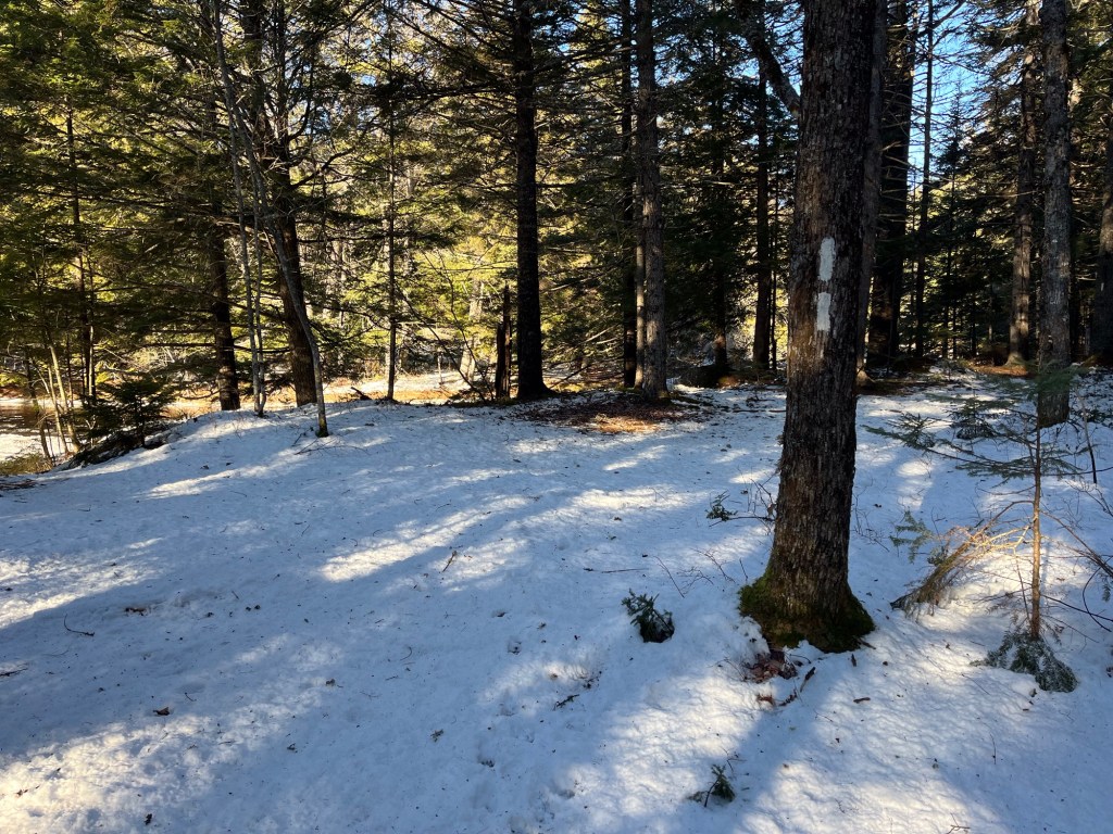
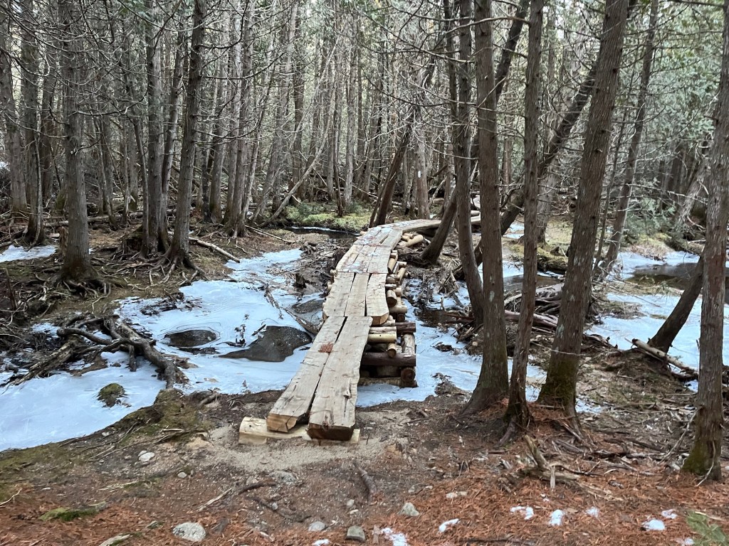
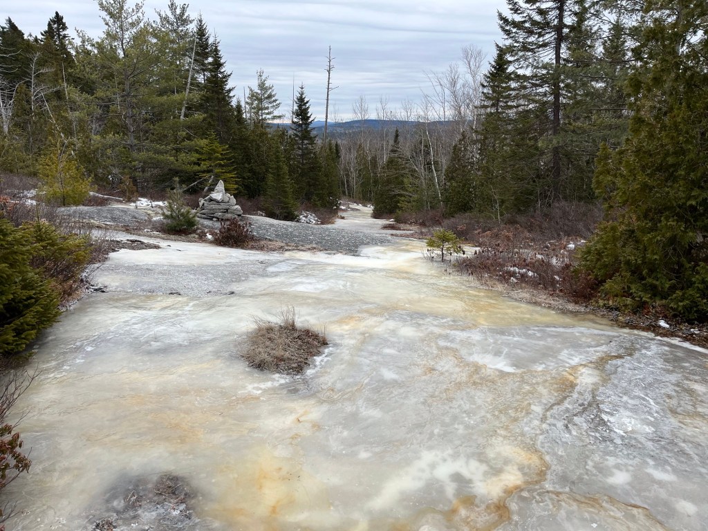
After a couple hours of driving, we did a last minute resupply at the general store in Millinocket before heading into the park. This first day of hiking was pretty easy going. In about 20 degree weather, we had a nice, sunny 10 miles to get to Katahdin Stream campground where we’d set up camp. The terrain sloped very gently uphill, and was mostly thin, crunchy snow. Only a few spots had us penguin-walking over glare ice; a warning of what we had in store for us the next day… I took a nice break at Big Niagara Falls to enjoy the scenery and warm up with some coffee that I’d packed out in my thermos. My thermos would quickly prove to be one of my favorite pieces of winter hiking gear!


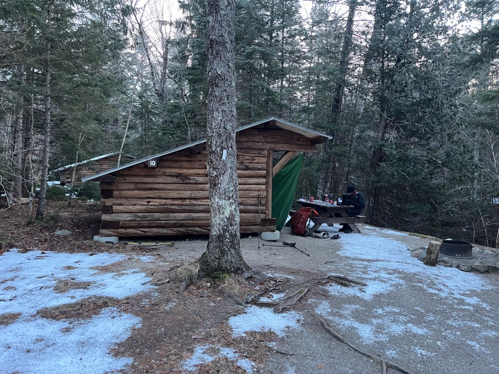
I arrived first to Katahdin Stream from our party, and took our pick of one of the many vacant lean to’s. Seriously, there was not a single other soul to be found. I used the last of the remaining daylight (a precious commodity) to set up camp and build a fire for the rest of the team. Tonight, it would get down to about 5 degrees, making for the coldest weather we’d see in our outing.
Camping at well below freezing makes a few things pretty cumbersome. Every small task becomes much harder when your fingers are numb, to start. Starting a lighter, changing your socks, brushing your teeth; all of these things are much less appealing at 5 degrees than your sleeping bag. Katahdin Stream itself flowed just next to our campsite, so we were able to collect water with ease. However, the stream water would very quickly freeze after it was collected, so cooking and eating was always a race against the clock.

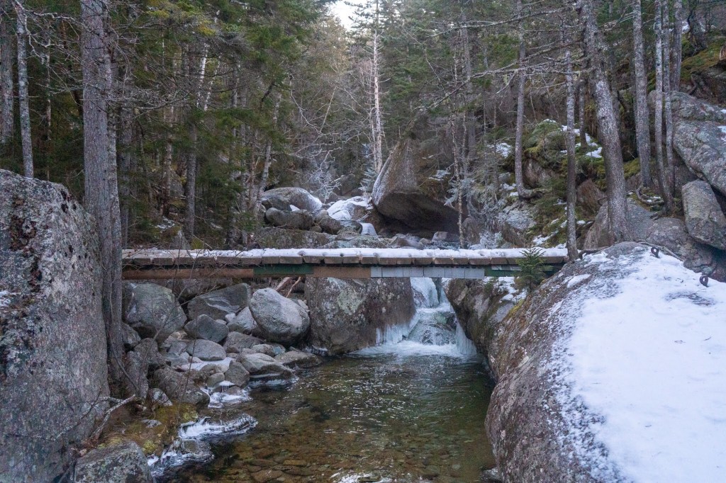
The next morning, Sunday, December 15th, was summit day. The weather was looking like it was going to be great, with a 32 degree high, gentle winds, and clear skies. I woke up at 5:00 AM sharp and prepared to meet the day’s challenge. At 6:30-ish (later than we’d hoped), we set out. Things were pretty easy at first. 1.2 miles in, we encountered Katahdin Stream Falls. I thought things were going pretty easy, having cruised through this first part in no time. HOWEVER! The next mile after Katahdin Stream Falls was an unrelenting uphill skating rink. You see, it had rained a few inches in Baxter park a couple days before our arrival. The ranger station had even called our group to warn us of the ice, but we were determined. Well, it was slick, and definitely slowed down our pace headed up. I fell only once (fall count = 1)!

After braving that icy nonsense, we encountered about a half mile or so of waist deep snow. Occasionally, you could walk on top of this crusty snow, but about half of the time you’d fall through. I had the privilege of being first in our group, and thus being the one to break trail for the others. This half mile of uphill hiking in waist deep snow was by far the hardest hiking of the entire trip. Clawing my way through the snow was exhausting, but it made hitting tree line and escaping into easier terrain such an enormous relief! I thought to myself that if the rest of the hike was going to be that hard that we wouldn’t make it!

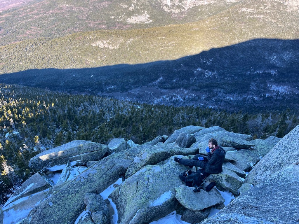
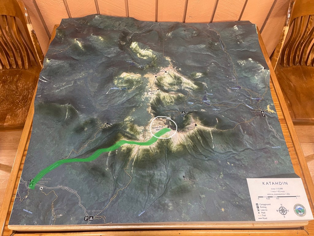
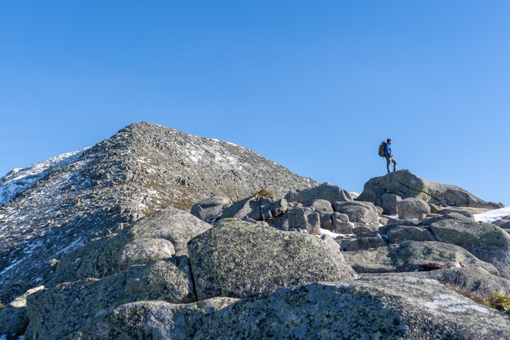
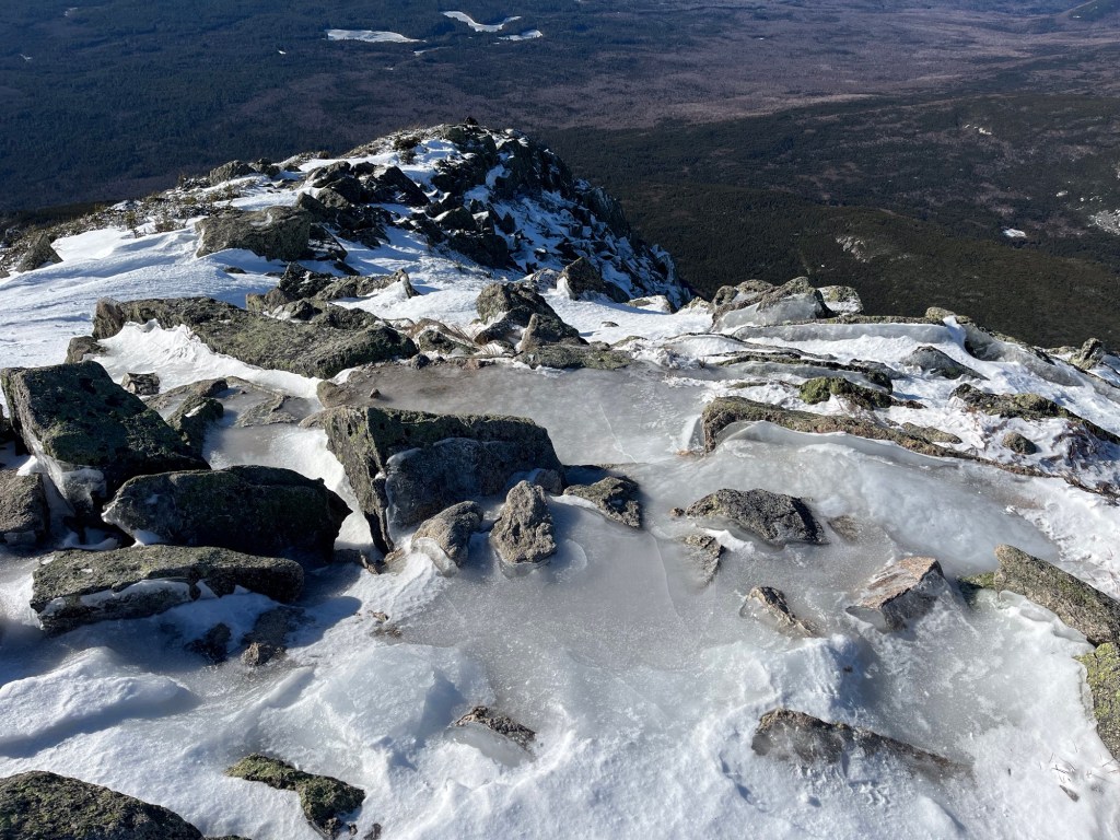
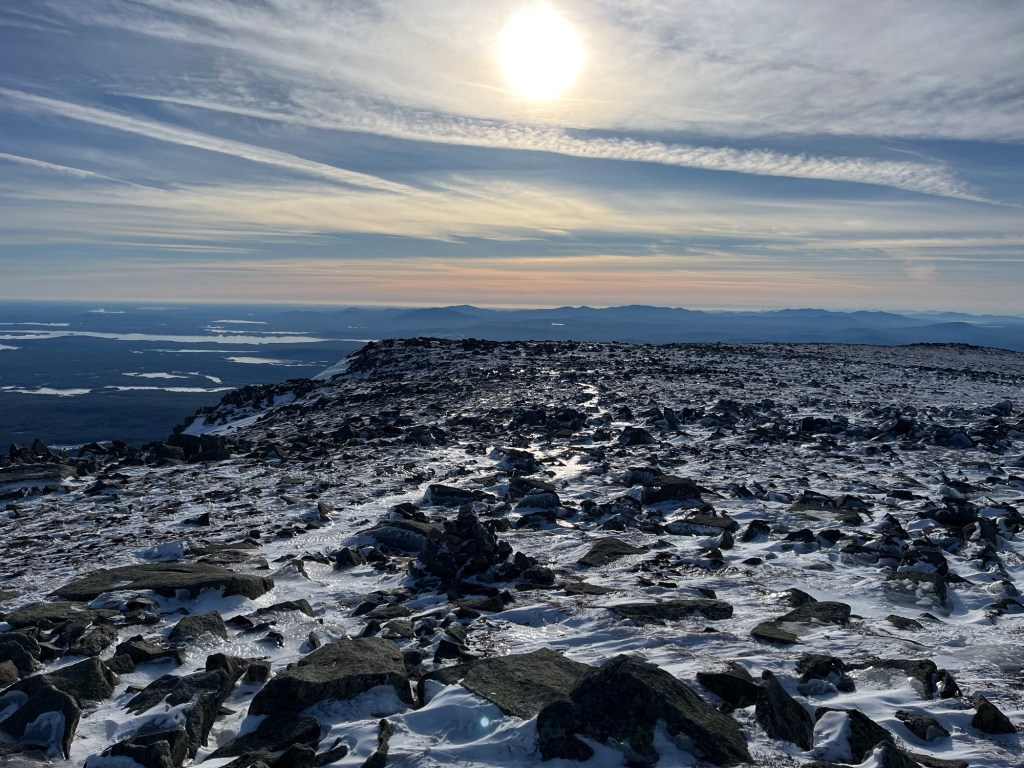
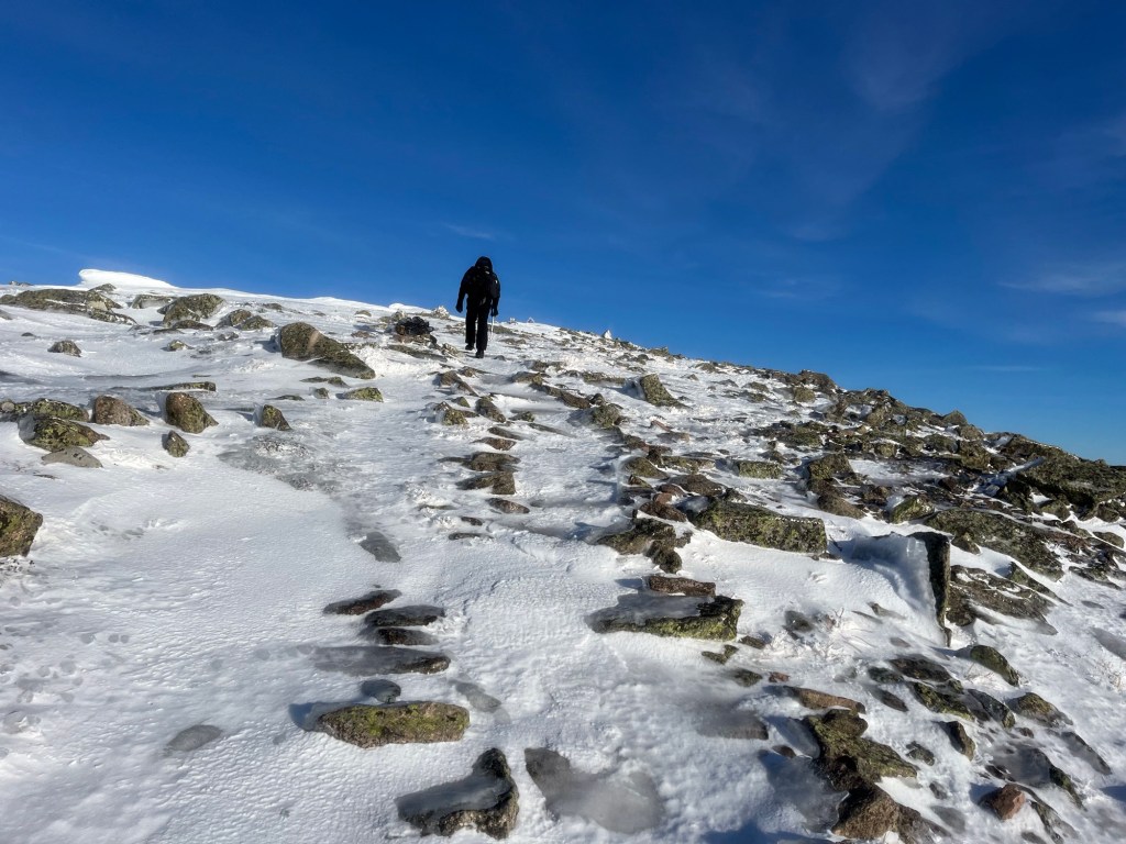
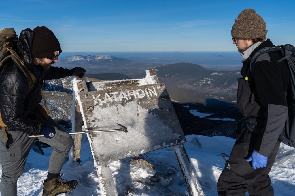
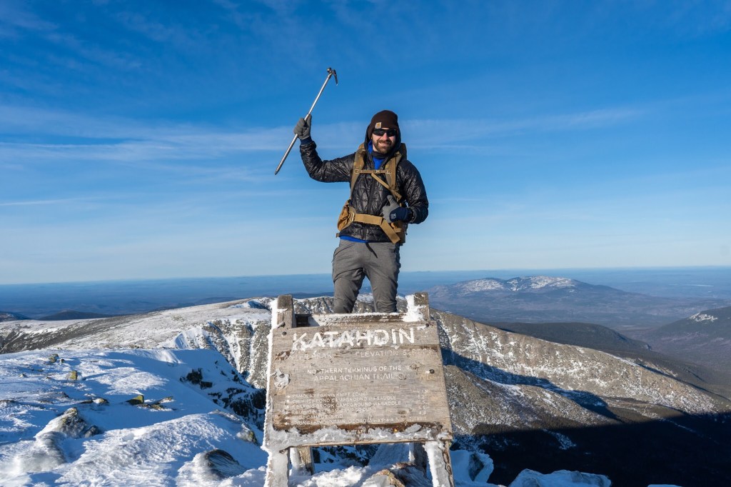
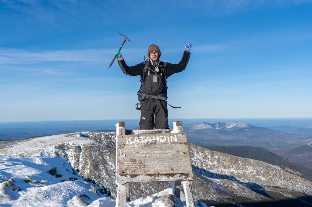
Alan and I tended to be faster hikers than Hot Foot and Van Gogh, so for the remainder of the hike, we took a strategy of hike a bit ahead, then wait a bit for folks to catch up. Hiking above the tree line became a jungle gym of rock scrambling and bouldering, which, I thought, was actually a lot of fun. This was the first time in the trip that I busted out my ice axe, which immediately proved its utility as a stabilizing cane, a rock grabber, and an arm extension. Just about 0.8 miles traverses this rocky part of trail called the Hunt Spur. With he clear weather we had, the views were amazing.
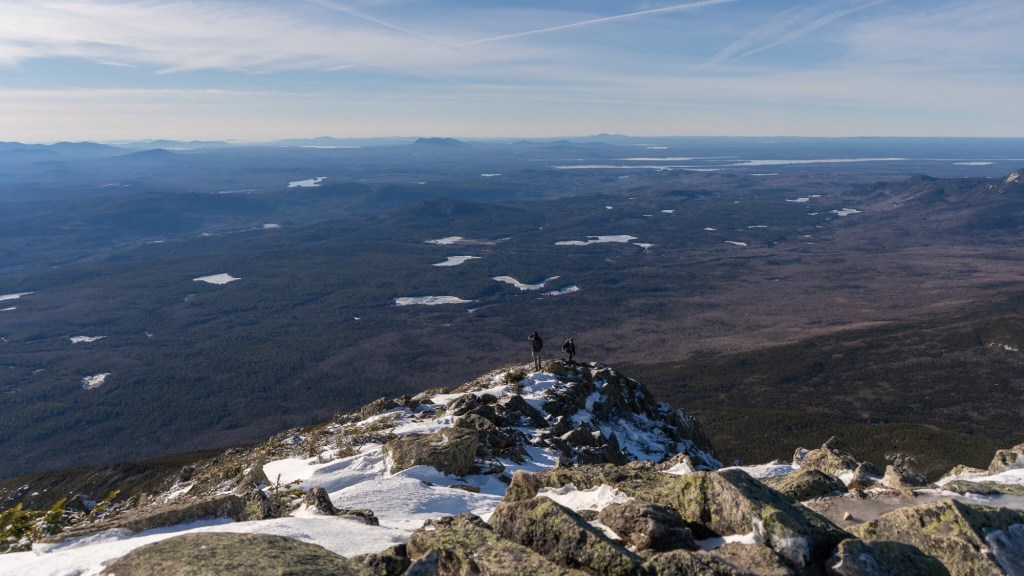

The steep boulders of the Hunt Spur give way suddenly to the much less steep Tablelands at The Gateway. Here, signs warn hikers to stay on trail to protect the fragile alpine plants. Most of these plants were under several inches of ice and snow, making them safer, now, to walk on. Though the Tablelands were a pretty gradual climb, they marked the resurgence of glare ice. I fell twice (fall count = 3), Alan fell once (hard) on his knee, Hot Foot landed on his elbow, and Van Gogh had a couple of falls that looked pretty dicey to me. With just about a mile to go, though, before reaching the summit, we were bound and determined to press onward. The end of the entire through hike was within sight!
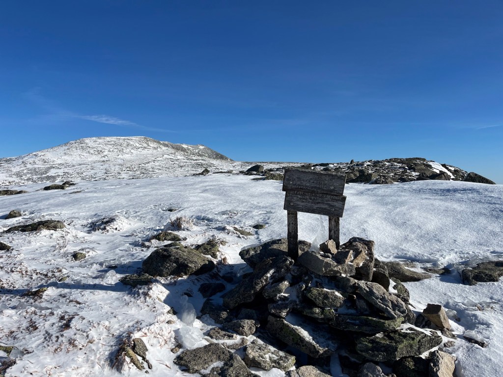

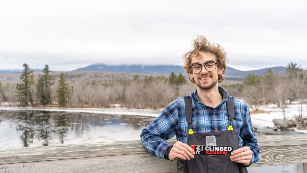
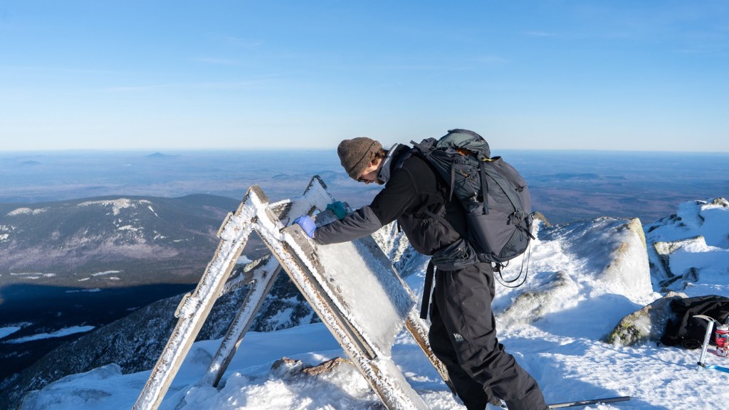
Finally, at just about 2:00 in the afternoon on December 15th, after hiking 2,197.4 miles from Springer Mountain, Georgia, having countless adventures, meeting tons of great people, and having never given up, my thru hike of the Appalachian Trail came to an end at a little wooden sign on top of Mount Katahdin. It is hard to articulate the sense of accomplishment that one feels at a moment like this. I am proud of myself for having completed what I set out to do, something that most people fail. I am thrilled to share the moment with friends I met along the way. I am filled with an overwhelming sense of personal accomplishment and relief. We all took our moments to feel whatever it was we needed to feel then and there.


I made a quick call to my mom at home (the summit was the only place we’d get cell service in the entire park) to let her know that we’d made it safely and were headed back to camp. Speaking of which, it was getting late (2:30 PM), and it was becoming increasingly cleat that we would not make it back before dark. However, it was at least our goal to make it below tree line by dark. At least it was all downhill from here!


We descended the Tablelands and the Spur carefully, noting that if there were any potential for an accident that it would be above tree line. Just as it became too dark to see without a headlamp, we made it to back to the snowy section boxed in by trees. Alan and I jetted ahead to camp, practically skating down the slick icy sections (fall count = 5) just to get back to camp for some well earned fire and food. Sleep came easy that night. We all made it up and down the mountain safely and successfully.
The following day, we took the Blueberry Ledges trail back to the parked car, which shaved about 5 miles off of our route to Katahdin Stream. The Blueberry Ledges trail may have been shorter, but boy was it icy for a little ways. I felt like I would be better suited with a bobsled rather than my hiking boots. I was relieved to get to the car, where I was finally able to take off my 50 pound pack and relax while I waited for the rest of the group to arrive.
And with that, that was it. We drove back to Kingfield, stayed another night at the Terrapin Hostel, and parted ways the next day. I flew back to Wisconsin, Hot Foot remained in Kingfield to work the rest of the winter at Sugarloaf, Alan headed back to PA to take third in a bouldering competition, and Van Gogh went back to MD, presumably to tell Riley about what he’d missed out on.
Overall, what an epic way to finish a thru hike. I’m so glad to have had the opportunity to see this whole crazy thing through in such a unique way. I will never forget the adventures I had on the whole of the AT, but the frozen finish will, I’m sure, stick out in my memory.
I’d like to share my thoughts on how the hike has changed me, what I’ve learned, and what I might be planning next. But, since I know this post is getting long, I’ll leave those details for a future post. For now, thanks for reading, and I’ll catch up with y’all next time!

Congratulations, Colin! I have always known you to be a remarkable person, and this is one more piece of it. I will share this with Matt. You are also a fine writer. I look forward to reading more!
LikeLike
Thank you so much! I’m glad you enjoyed it! Tell Matt I’m always down for a good run now that I’m back!
LikeLike
this is such a great story! Way to go!! Stephanie
LikeLike
this is such a great story! Way to go!! Stephanie
LikeLike
Alpine—this brought such joy to read; forgive me for failing to reply earlier. Congratulations on a monumental finish to your monumental thru-hike. You are a generous, adventurous, and kind man. And somehow, you managed to be hospitable in the wilderness without homes. The rest of the world may not ever understand fully what you’ve accomplished, but don’t let go of all you’ve learned and who you’re becoming. I’m thankful to have been following your journey and to have had the chance to try to keep up with your racehorse hiking speeds. Congratulations, and happy trails to you 🙂
LikeLike