Crossing the border, trail names, NOC, etc.

Hi folks!

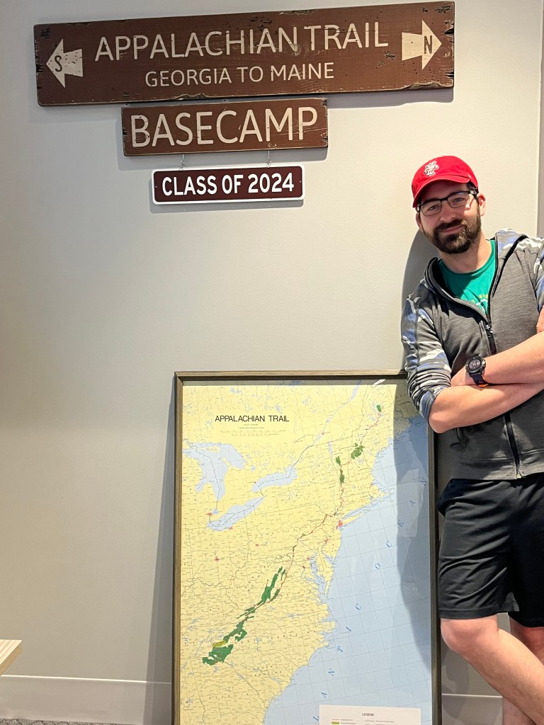
I’m still alive, well, and hiking north! I’ve hit more than a few milestones since my last post, including crossing my first state border, hiking my first 100 miles, and getting a trail name!

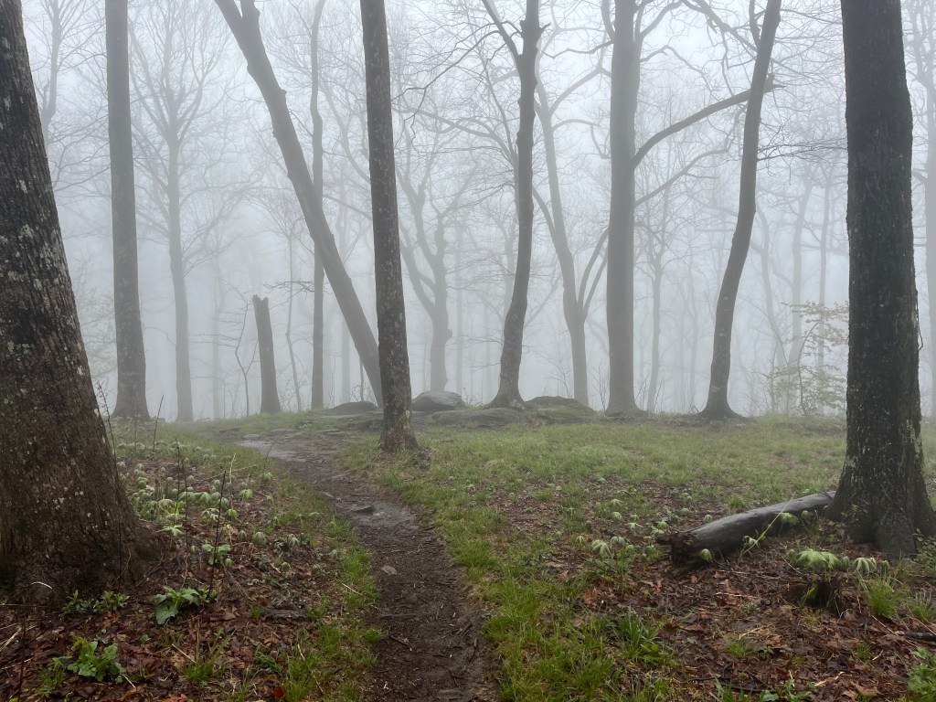
Passing the threshold into triple digits and putting an entire state behind me have gone a long way in making this hike really start to feel like a long term endeavor. It has not been an easy thing, either mentally or physically, to transition into a thru hike. My legs are still getting accustomed to hiking as a full time job, for example. It’s a lot to ask of your joints to carry you up and down mountains for eight hours a day. I’ve met a few folks that are re-hiking the trail that assure me that trail legs will start to kick in in a big way about a month into the trail.

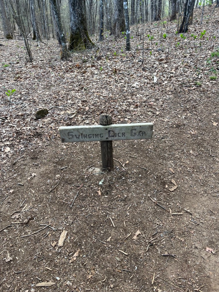
I got a trail name this past week, too! For background, a trail name is a nickname that many hikers adopt on trail; usually something unique to the person, or in recognition of something that occurred on trail. I’ve met folks by the name of Stetch Banana, Solar, Neat, On the Rocks, Papa Jim, Nimrod, Pizza Bastard, Tech, and many more. The other day, a guy stopped me in the middle of the woods to compliment me at great length over the particular way I walked with my trekking poles. He said I walked with a definite alpine style. I had very little idea what he was actually talking about, and it seemed to me that his head might have been in an alpine zone, if you know what I mean. The exchange was so bizarre, that I adopted the trail name Alpine.

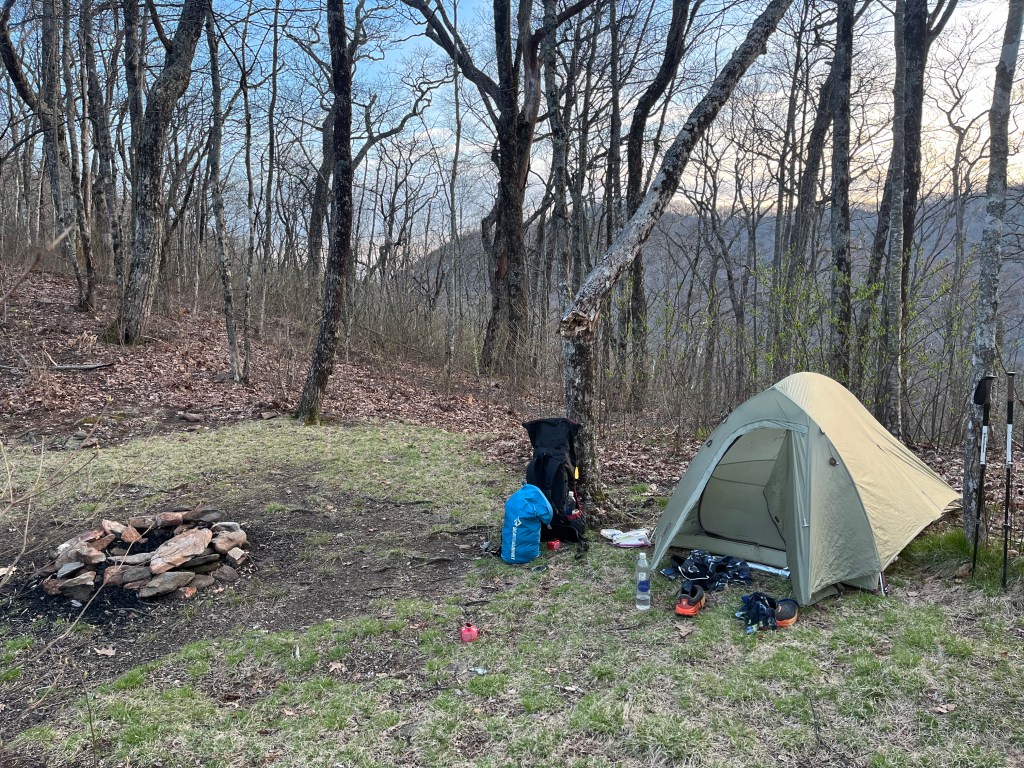
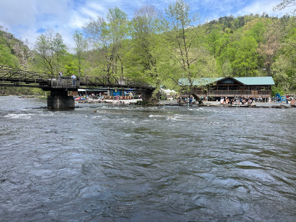
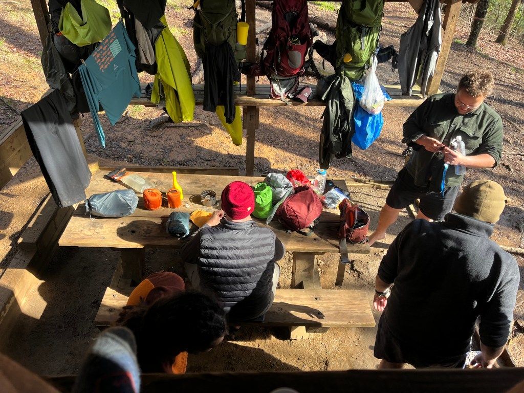
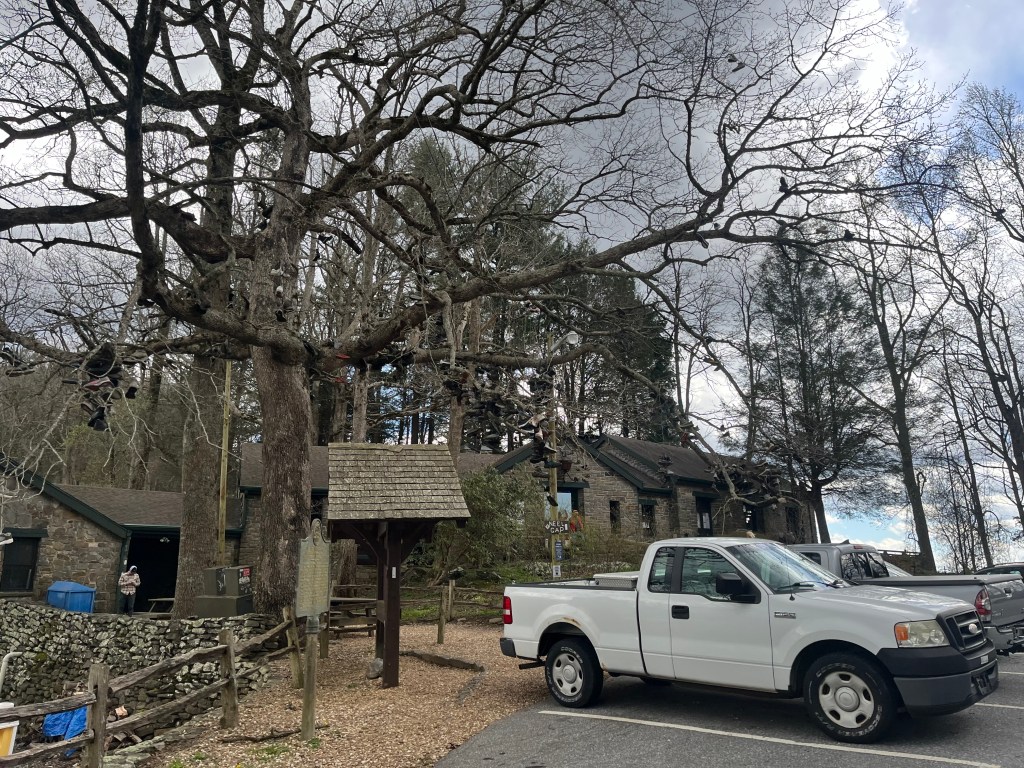
Today, I took a nearo (hiker slang for a near zero mileage day; a shorty) in Nantahala Outdoor Center (NOC), a river rafting and outdoor hub here in North Carolina. It was a pretty well-timed break, as they had a spring fling festival to kick off their season. There was discounted food, vendors, and live music. I hiked 6 miles into NOC this morning with a couple of other hikers, and just spent the rest of the day enjoying the sun and resting up. That’s good, because we will have quite a day of uphill hiking tomorrow to get back up into the mountains. As one might expect, whenever you hit a river when hiking on the AT, it will be shortly followed by a precipitous ascent.

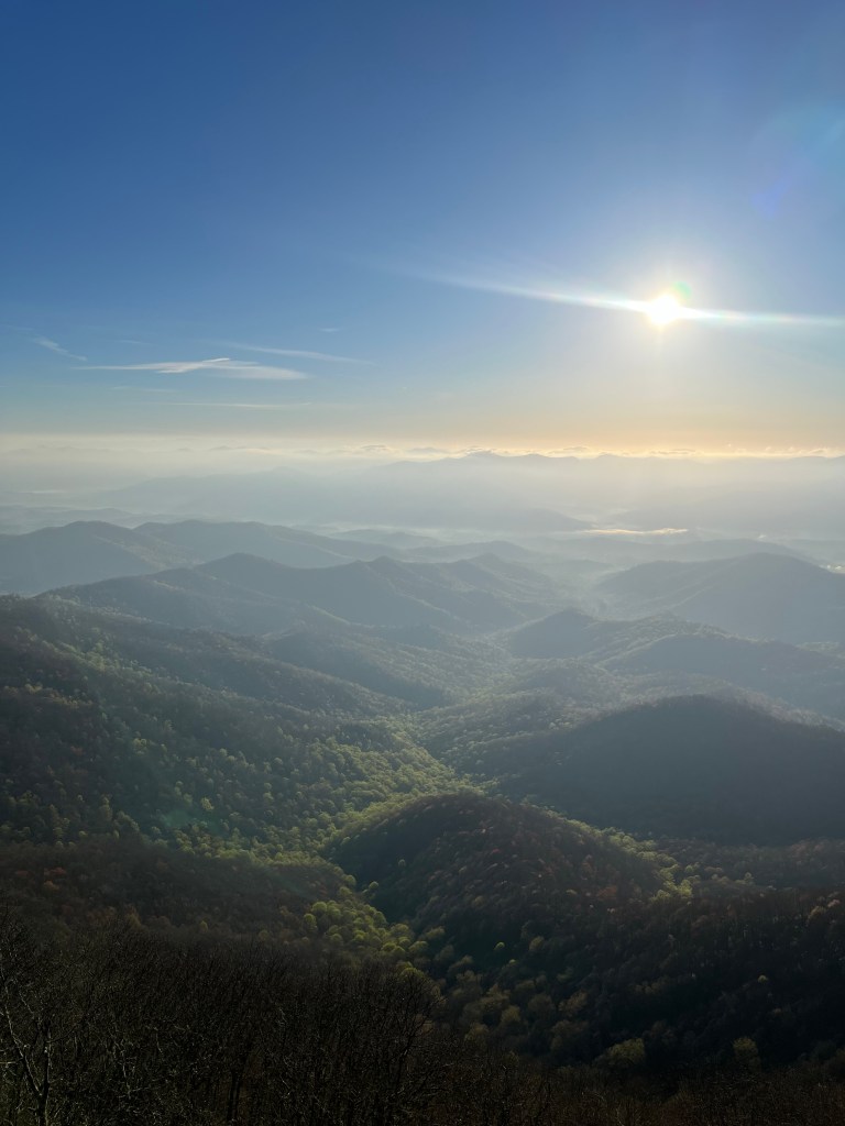
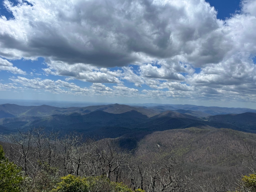
Weather has continued to be pretty great, with just one instance of rain yesterday morning. When the weather is clear, it becomes so easy to hike through really decent mileage. Yesterday, I hiked my longest day so far at 18.9 miles (hence my nearo today). Fingers crossed for more of the same.

Incidentally, if you’ve ever wanted to read/listen to more books in your life, might I recommend a thru hike? So far, I’ve finished three books while hiking, and that’s not even listening all the time. I’ve made it a goal to finish Robert Jordan’s “Wheel of Time” series on this hike. I just finished book 2. If anybody has any good book recommendations, I’d gladly hear them in the comments!

That’s it for now, folks! I’ll talk to you again sometime soon!

Ambling up and down in Georgia

Hi folks!

My hike is progressing just great! At this point, I’ve hiked up to mile marker 69.4, Dick’s Creek Gap near Hiawassee, GA. Tonight, I’m staying at Green Dragon hiker hostel.

The last few days have had gorgeous weather, with full sun and gentle breezes. Coming from Wisconsin winter, I’ve gotten a small bit sun burned being constantly in the southern sun, but I’m faring well overall. The last couple of days have presented some of the toughest hiking so far, with steep climbs up Tray Mountain and Kelly Knob, offering thousands of feet of elevation gain in only a couple of miles. Honestly, though, the downhill portions have been rougher on me. My ankles and knees definitely begrudge any hike down into one of the many valleys on the trail.

Let me walk you through a day in the life of a hiker on the Appalachian trail. Most hikers wake up with the sun, or slightly before in my case. I cook a quick breakfast, usually oatmeal and instant coffee, before hitting the trail by 7:30-8:00ish. I will typically hike in increments of roughly two hours, taking breaks in between to snack and/or collect and filter water from streams along the way. Once 2:00 hits, I’ll start to plan out quite where I want to end the day. I like to finish my days up at or near one of the shelters on trail, as they serve as hubs to meet with other hikers. Once I pick my finishing point for the day around 4:00, I’ll relax for a bit before filtering more water, setting up my tent, and then cooking dinner and chatting with other hikers. “Hiker midnight” usually occurs at around 8:00, when most everybody turns in for the night to rest and recharge for the next day of hiking.

Today, I hiked 12 miles before meeting up with a shuttle driver at Dick’s Creek Gap. They drove me to where I’m staying tonight at the Green Dragon hiker hostel. There are 11 other hikers staying here, two of which I know from trail. This place really is super nice. For just $55, they offer a shuttle to and from the trail, as well as a trip to town to resupply at the grocery store, and a trip to a local restaurant to pig out on some actual food, laundry and shower service, and a home cooked breakfast tomorrow, too! Very excellent place, and Bill and Donna, the owners, are marvelous people. 10/10 would recommend. What’s more, the mayor of Hiawassee hosts a free burger cookout in the town park for hikers every Monday, so I got to partake in some delicious free food courtesy of the town of Hiawassee.

Tomorrow, I’ll be shuttled back to Dick’s Creek Gap, where I’ll resume my hike. The next opportunity to resupply will be in Franklin, NC. That’s exciting, because it means that the next time you hear from me, I’ll be finished with Geargia, the first state on the AT! Very exciting stuff.

I don’t have too many pictures this time around (I’ll try to be a better photographer in the future), but I’ll give bonus points to anybody that can identify this weird plant (or fungi?) that I encountered right on the side of the trail.

First three days on trail!

Hi folks!

I have officially been in trail for three days. I’m writing to you now from the hiker hostel at Neel Gap. There is not only a place to stay here, but also the first opportunity to resupply on trail.

I can say this much with absolute certainty now: if you are looking to hike the AT, you had better be prepared for and ready to hike in the rain. My induction into the hiking world included two solid days of hiking in torrential rain. Rain gear is great to have, but I guarantee that after 8 hours of hiking with no cover but the leafless trees, you will be wet. So wet that at the end of the second day, I was able to wring out a solid cup of water from my sodden underwear (don’t worry, this was not the cup of water later used to cook my dinner).

As it has been so wet, I have spent my first nights on trail at shelters instead of pitching my tent. For those unaware, the AT has shelters every 10 miles or so available for first come, first served hiker use. A shelter is more or less a three-walled hut with a roof. Sometimes, as was the case with the shelters I overnighted at Stover Creek and Gooch Gap, these shelters have a second level. They provide an excellent opportunity To get out of the rain and wind, but there is ample evidence of mice and squirrels, so care needs to be taken to hide your food and gear.

I’ve spent the night at the shelters with a hodgepodge of other hikers. It’s a pretty good mix of folks of all ages, genders, races, etc. It is generally pretty easy to strike up a conversation with folks, though. After all, no matter how different you are from the person sitting next to you at the shelter, you at least were both crazy enough to try and tackle the AT, so you’ve got that in common.

So far, my breakdown of mileage looks like such:

Day 1: 11.8 mi – Amicalola Falls to Stover Creek

Day 2: 12.9 mi – Stover Creek to Gooch Gap

Day 3: 15.6 mi – Gooch Gap to Neel Gap

The hostel here at Neel Gap sleeps 12. There are 6 here so far; all thru hikers. Very nice people, though nobody knows how to play cribbage. I’ll try not to hold that against them.

I would be lying if I said I was not homesick the first couple of days. As the rain pelted down on me, I found myself wondering if I’d made the right decision coming out here. However, the sunshine today and the company of the nice folks I’m staying with tonight have done wonders in turning my mindset to the optimistic end of the spectrum. I also got a nice pizza here at the outfitter, which I’m sure also helped. I remind myself that good things are seldom easy. With my newfound resolve, I’m thinking I may hike 18 miles to Blue Mountain Shelter. We will see how I’m feeling in the morning. The WiFi isn’t great here, so I can’t post photos, but I’ll update y’all with some imagery next time!

Arkansas, the eclipse, and horsing around

Hi folks!

I’m writing to y’all from Ellijay, Georgia, just about 30 minutes from Amicolola State Park, where I’ll start hiking tomorrow morning. To be clear, the official southern terminus of the Appalachian Trail is at Springer Mountain. However, because it is a bit more accessible, many thru hikers begin their trips at Amicolola, which is an 8-ish mile hike from Springer. I’ll be hiking this approach trail.

Georgia, however, was not the first place I went after leaving home. I made a detour to northern Arkansas, where my parents have a permanent camper site at Caney Mountain Horse Camp near Big Flat. We spent the past few days trail riding in the Ozarks. This was my first trip to Caney, and I was not disappointed. The trails around the camp offered waterfalls, panoramic views from sandstone bluffs, and crystal clear rivers. Over three days, we rode somewhere north of thirty miles. Better than the nature, though, were all the new friends I had the pleasure of meeting. I was so grateful to meet some of the great people that my parents have come to know over their years visiting Caney. Special shout outs to Wendell and Sue for being such fun, kind folks, and to Uncle Thomas for cooking me up some mean delicious Louisiana gumbo.

Of course, while I was in Arkansas, I had to see the total solar eclipse. We spent eclipse day by riding our horses across the Buffalo River and to the top of Spencer’s Bluff, where we had a perfect, cloudless view of this awe-inspiring celestial event. I wish I had even a halfway decent photo of the eclipse, but I’m sorry to say I don’t. When I realized I couldn’t rightly get a proper photo, I quickly tried to focus on just taking in the eclipse with my own eyes, and making a memory the old fashioned way; simply by experiencing it. It was a truly surreal thing to experience, and really got me thinking about how important it can be to just sit back and appreciate the present moment.

After the eclipse, my mom and aunt Deanne were kind enough to drive me to Georgia. Sitting here in the hotel room, I have gone over my gear and made sure I’m all ready to hit the trail tomorrow. I think I’m all set and ready to go. When next I update y’all, I’ll officially be on the trail!

I’d like to give a special shout out to my parents, Ken and Kristin. I am so grateful to have spent such a memorable time with them just before leaving on this grand adventure. They truly are some of the nicest folks I’ve had the opportunity to know. I love you, mom, who I assume is actually reading this. Do me a favor and pass the message on to dad, too!

I’ll update y’all next from the Appalachian Trail!

CPT

Leaving home!

Hi folks! I am officially on my way to the trail! I am presently on a shuttle to MSP, where I’ll be flying out tomorrow morning. I’ll be staying tonight with my best friend in the cities, so major shout out to Wyat for hosting me tonight!

Since there may be those of y’all that are unfamiliar with the Appalachian trail, I’ll provide a cliff notes synopsis of it. The Appalachian trail (AT for short) is a trail that runs approximately 2,200 miles from Springer Mountain, Georgia to Mt. Kathahdin in Maine, meandering its way through 14 states along the way. Those of us that endeavor to hike the entire length of the trail in a single season are referred to as “thru hikers”. With a little bit of determination, in 5-6 months I’ll be able to count myself amongst those who have successfully completed an AT thru. Many start, and many fail. Estimates vary, but the Appalachian Trail Conservancy (ATC) ventures a guess of a 20% success rate for the hike attempts. Any number of things ranging to injury, loss of interest, lack of funds, or unexpected emergencies can lead one to tap out of their trip.

I’m starting my adventure with confidence. I’m sure a lot of people do. I am not nervous, and I’m looking forward to encountering the unexpected. I have never done this before. Save for some week-long trips, my back country experience is limited. Despite this, I believe my preparations have been adequate in preparing me for whatever rolls my way. I’ve had an eye on hiking the AT for years, and have been obsessively researching and preparing for what probably amounts to way too much time. Go ahead and ask any would-be backpacker how much time they’ve spent researching gear choices alone, and I’m sure you’d be disturbed by the figure. I’m looking forward to finally putting foot to trail after all these years.

I will not be starting the trail until April 10th. I’m headed to Arkansas first to visit my parents and check out the total solar eclipse on the 8th. More on that later. For today, I’m excited to have left home behind to start my adventure!

Hi, folks!

My name is Colin P Tingo, and this summer, I am going to successfully hike the entire length of the Appalachian Trail. This blog will serve a few purposes:

  • To let my friends and family know that I’m still alive and well; that I haven’t gotten lost in the woods, mauled by a bear, eaten by cannibals, or joined a cult.
  • To share my own take on an experience that few others will personally endeavor, and to answer any questions anybody may have on the how and why of it all.
  • To have a little something for myself to look back on.

I’ll try to publish a post every week or so, depending on what access and time looks like once I hit the trail. I’ll be posting in greater detail about myself and the start of my hike in the coming days. For now, consider this the first of many posts about what I’m sure will be a grand, exciting, and successful adventure.

Happy trails,

CPT